Ifria Cartography
Occitanie apprentices map · Ifria
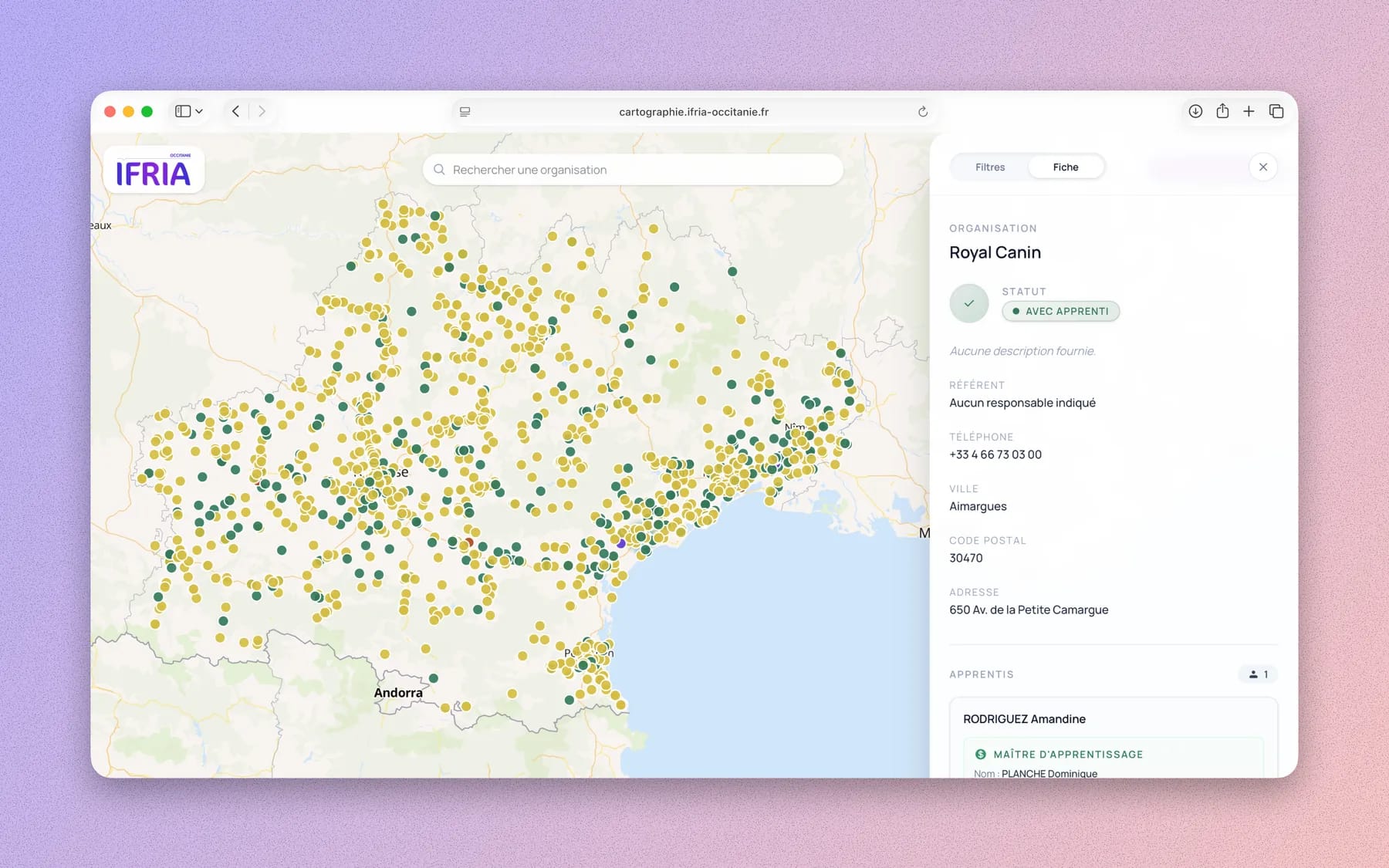
Cartography tool built for Ifria Occitanie to visualise apprentices, schools and companies across the region. The goal was to turn Excel tracking files into an interactive map that the team could use easily, without requiring a complex GIS tool.
The Next.js application displays datasets with MapLibre, mobile-first filters, contextual popups and a responsive interface. A password-protected area lets users upload Excel files, which are converted to JSON server-side and automatically transformed into GeoJSON for display.
The project is intentionally simple technically: few dependencies, file persistence, secured upload and easily replaceable datasets. It solves a precise business need: making the regional distribution of apprentices, schools and companies readable from data the team already had.
 Next.js
 MapLibre
 TypeScript
 Tailwind
 Docker
 Git